Introduction
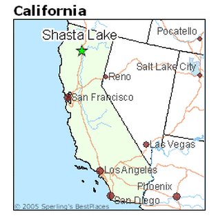
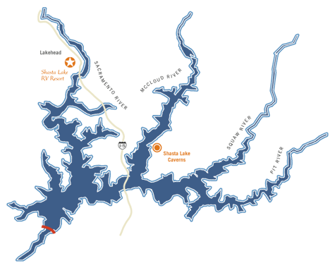
Shasta Lake is a reservoir located in Shasta County, north central California. This lake is located due east of Eureka by approximately 160 miles and is geographically situated at the interface between the Central Valley, Klamath Mountains, and Modoc Plateau and Cascades geomorphic provinces. The lake itself and surrounding area are underlain by rocks of the Klamath Mountains; the Modoc Plateau and Cascades geomorphic provinces are of limited extent. Regional topography is highly dissected, and the region consists primarily of ridges and canyons with vertical relief ranging from the surface of Shasta Lake at 1,070 feet above msl to ridges more than 6,000 feet above msl. This topographic variability is a result of the structural and erosional properties of rock units in the vicinity of Shasta Lake. Shasta Lake is roughly 121 square km in area, and has an approximate surface elevation of 326 m. The main inflow sources to the reservoir are the Sacramento River and Pit River; the reservoir is impounded by the Shasta Dam.
|
|
Objective
The objective of this study is to conduct a temporal analysis of Lake Shasta to identify and assess water level fluctuations that are influenced by the drought/flood conditions which have occurred between 2011 and 2015. Specifically, the soil/water boundary will be targeted to account for these changes. Any evidence of environmental change or anomalies identified during data processing in this region will be identified, and the source of the change, natural or anthropogenic, will be further assessed to determine the likely cause.
The soil/water boundary is the primary target for this investigation, as it may be the primary indicator of water level fluctuation. The soils in Shasta Lake and the surrounding vicinity derive from materials that have weathered from metavolcanic and metasedimentary rocks from intrusions of granitic rocks, basalt, and serpentine (www.usbr.gov). Typically, metamorphosed rock do not weather at a rapid pace, and shallow soils are common within this designated area - especially in areas of highly varying topography and dominated by steep landscapes.
The soil/water boundary is the primary target for this investigation, as it may be the primary indicator of water level fluctuation. The soils in Shasta Lake and the surrounding vicinity derive from materials that have weathered from metavolcanic and metasedimentary rocks from intrusions of granitic rocks, basalt, and serpentine (www.usbr.gov). Typically, metamorphosed rock do not weather at a rapid pace, and shallow soils are common within this designated area - especially in areas of highly varying topography and dominated by steep landscapes.
Academic Outcomes
The goal of this research project is to apply knowledge gained from ES 771 Remote Sensing involving internet imagery search and downloading, data download and processing, and data interpretation and reporting. Methods, processing techniques, and findings are based on class experience from laboratory exercises, exam responses, and reading assignments.
This webpage was created for use in ES 771 Remote Sensing, Emporia State University. Spring 2015. Dr. James S. Aber, Professor. Authored by Corey Miller, Graduate Student. Header image acquired online www.usgs.gov
